

Ongoing construction across Marco Island, especially near North Collier Boulevard and North Barfield Drive, is slowing traffic and forcing drivers to rethink how they move around the island. With lane closures and roadway changes expected to continue through 2026, congestion has become a daily reality for many residents and students.
Current Major Project: North Collier Boulevard & North Barfield Drive
Construction began in September 2025 on North Collier Boulevard to accommodate underground main installations. From late February through August 2026, roadway demolition, median reconstruction on North Collier, and widening of North Barfield for new through lanes are scheduled. Traffic signal upgrades are planned from February through July, with full completion projected for September 2026. All of which leads to more road closures throughout the remainder of the year.
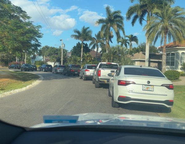
Since the southbound lane closure began, backups have regularly formed along North Collier. Traffic often begins at the island’s entrance and, at its worst, has been congested all the way to Fiddler’s Creek.

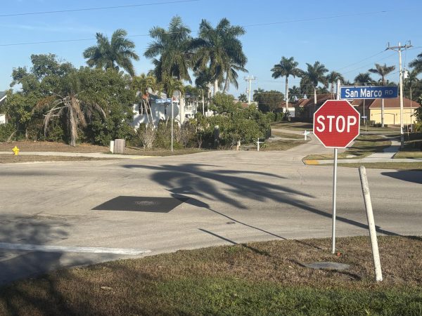
When traffic becomes heavily congested at the main island entrance, some drivers try to enter Marco from the opposite direction by taking Tamiami Trail East and turning onto San Marco Road. While this route can sometimes relieve pressure at the primary entrance, it has also experienced construction activity and inconsistent lane closures, making travel times unpredictable. One student, Brinley Heflin, tried using this alternative but found it was not much faster. “It normally takes me 20 minutes max to get to school,” she said, “but I had to sit in traffic that didn’t move at all, and it took me over an hour.”
To work around congestion along North Collier, many drivers have been cutting through Yellowbird Street to Sixth Avenue. This short east–west connector links North Barfield and Collier, allowing vehicles to bypass the most congested portion and access the south end of Barfield Drive via Collier.
Another commonly used detour utilizing Fairlawn Court was closed due to congestion.
This closure increased traffic on Yellowbird Street and Sixth Avenue, making the already unprepared route even worse. Joaquin Perez, a student who lives in the area, said, “The traffic increase on Yellowbird is not only an inconvenience to locals but also dangerous,” as Sixth Avenue has a traffic circle that many drivers struggle to navigate, especially with the influx of traffic.
Drivers needing to reach the north side of Barfield Drive have also shifted to Bald Eagle Drive, which runs parallel to Collier as a north–south corridor. From North Collier Boulevard, vehicles head north on Bald Eagle and then cut east on connecting residential streets to reconnect with Barfield beyond the most congested section.
February–June 2026: Asphalt Overlay of Roadway Dips and Manhole Bumps
In addition to major intersection and signal projects, the City of Marco Island has scheduled asphalt overlay work to address roadway dips and manhole bumps across various streets. This maintenance project focuses on smoothing uneven pavement surfaces that can cause vehicle wear, drainage issues, or sudden braking in traffic.
This construction was already completed on various manholes on San Marco Road. During the construction phase, a very small single lane closure was in place, which was easy to go around and barely impeded the regular flow of traffic.
February–August 2026: Pedestrian Safety Improvements
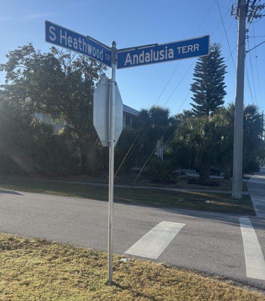
Between February and August 2026, two new crosswalks are scheduled for installation at South Heathwood Drive and Andalusia Terrace, and on North Barfield Drive between Wavecrest Court and Piedmont Court.
Although these projects are smaller in scale than the N Collier and N Barfield intersection improvements, construction will likely require temporary single-lane closures and short-term lane shifts. During active work periods, drivers may experience intermittent stops as equipment and materials are moved into place.
While these delays are not expected to be as severe as those along North Collier, drivers may still encounter short stops and reduced speeds near the work zones. The most effective way to navigate around them is to use nearby residential streets that run parallel to the affected areas. For example, when construction is active at South Heathwood Drive and Andalusia Terrace, Sand Hill Street, located just east of Andalusia, provides similar entry and exit access points while maintaining neighborhood connectivity. Additionally, Leland Way can be used to reach Mackle Park without passing through the construction zone.
April–October 2026: Traffic Signal Control Replacements
Following bidding in February and March, traffic signal control replacements are expected to move into construction from April through October 2026. The upgrades may involve replacing control cabinets, wiring, and signal equipment at various intersections, which may require signal outages or temporary lane closures while equipment is installed.
While the City of Marco Island Website does not currently indicate which roadways will be affected by this construction, the best way to avoid additional traffic would be to use nearby neighborhoods with stop signs rather than traffic lights once construction begins.
June–October 2026: Road Repaving Projects
Several neighborhood roads are scheduled for paving between June and October 2026, pending final approval of the bids. Planned streets include Neil Bahr Way, Tripoli Court, Antilles Court, Fruitland Avenue, Hartley Street, Admiralty Court, Hunt Court, Strawberry Court, Marquesas Court, and Wales Court.
These projects primarily affect residential access rather than island-wide flow. During paving, residents typically relied on adjacent neighborhood streets for entry and exit while crews temporarily narrowed or blocked sections of roadway.
May 2026–April 2027: South Barfield Drive Flood Remediation
Beginning in May 2026 and extending through April 2027, South Barfield Drive will undergo flood remediation improvements. This longer-term project aims to address drainage concerns but may involve periodic lane shifts or closures depending on installation phases.
Since the design of this project is scheduled to finish sometime in February and bidding is scheduled to begin in March, there is limited information present regarding the implications of the flood remediation project. However, it is a long-term project that may have major impacts on daily driving.
The Road Ahead
The City of Marco Island’s main advice on ongoing construction focuses on preparation and flexibility. Officials encourage residents to monitor the City’s website and social media platforms for updated traffic alerts.
The City also recommends carpooling or combining multiple errands into a single trip to reduce the number of vehicles on the road during peak construction periods. In addition, planning to travel outside of the busiest commuting hours (before 7:30 a.m. or after 5:30 p.m.) can significantly reduce time spent in traffic as work continues across the island.
As construction stretches through 2026 and into 2027, congestion has become an unavoidable part of daily life on Marco Island. Temporary lane closures have reshaped commute patterns across the island, affecting students, residents, and visitors alike. While officials emphasize that the projects will strengthen infrastructure, safety, and drainage in the long term, the short-term reality is slower travel and constant adjustments. For now, patience and flexibility remain essential as the island navigates one of its most significant roadway overhauls in years.


Jason • Feb 20, 2026 at 8:57 PM
Great job breaking down such a complex and frustrating issue. I really liked how you connected the construction timelines with real student and resident experiences—it made the impact feel very real. The explanations of alternate routes and upcoming projects were especially helpful. This article does a great job of informing readers while showing how these changes are affecting daily life on Marco Island.